“The Elsa depression [which is hitting the Azores this week] is far north of the continent's territory. What will most directly affect the weather is a complex depression of which Elsa is part,”said IPMA meteorologist Ricardo Tavares.
Speaking to Lusa news agency, Ricardo Tavares said that the wind will be "moderate to strong and very strong in the highlands, with winds of 95 to 100 kilometres / hour".
"The worst day in terms of wind and precipitation will be Thursday," explained the meteorologist, adding that the situation will continue for the next three to four days, with "very strong winds and heavy and persistent precipitation."
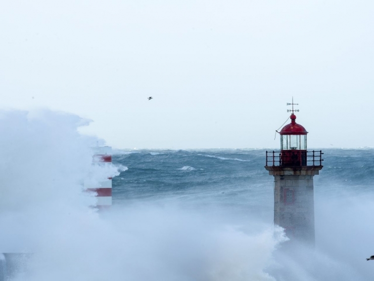
"It is also expected strong [maritime] agitation on the western coast and tomorrow also the south coast of the Algarve will be affected with southwesterly waves of four to five metres," he added.
According to Ricardo Tavares, yellow warnings (the third most severe) were issued for the entire continent, taking into account the expected precipitation and sea unrest.
For the North and Central regions, orange warnings are issued (the second most severe), which will be updated as the weather requires.
"From Saturday it is expected to see an improvement in the weather" he said.
The National Emergency and Civil Protection Authority today issued a warning to the population because of worsening weather conditions, with heavy and persistent rainfall, high winds in the highlands and strong sea unrest across the coast.
In its warning to the population, the Civil Protection warns of the possibility of "rapid flooding in urban areas, due to rainwater accumulation or inadequate drainage systems", and "flooding by overflow of water ways in historically vulnerable areas".
Worsening weather conditions can also lead to "possible accidents on the coast" and "geomorphological phenomena caused by the instability of slopes associated with soil saturation, due to the loss of their consistency".


